
Examples and Case Studies
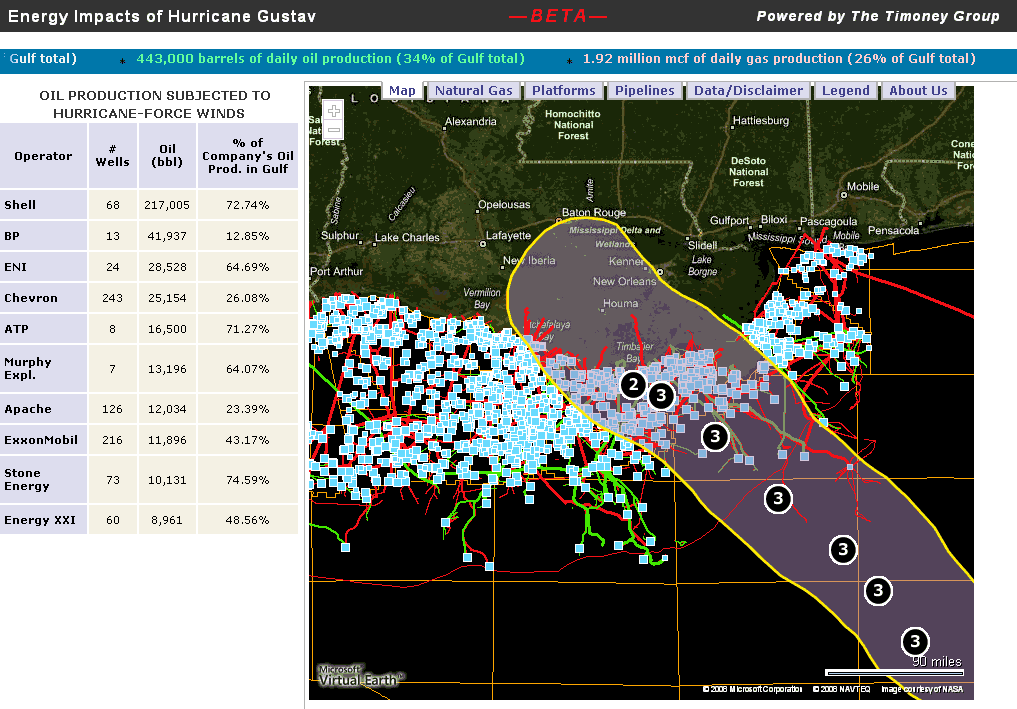
Hurricane Gustav Impact on Oil and Gas Production
The Timoney Group used HurricaneMapping's past wind swath in their analysis of wells, platforms, and pipelines that were subjected to Gustav's hurricane-force winds. Visit www.gulfimpact.com to see the full report.
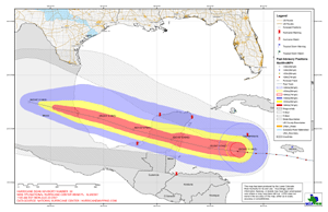
Hurricane Dean
Richard Diaz of the Lower Colorado River Authority in Austin, TX used a shapefile advisory dataset from HurricaneMapping to produce this map of Hurricane Dean's projected path.
See a full-sized PDF version of this map
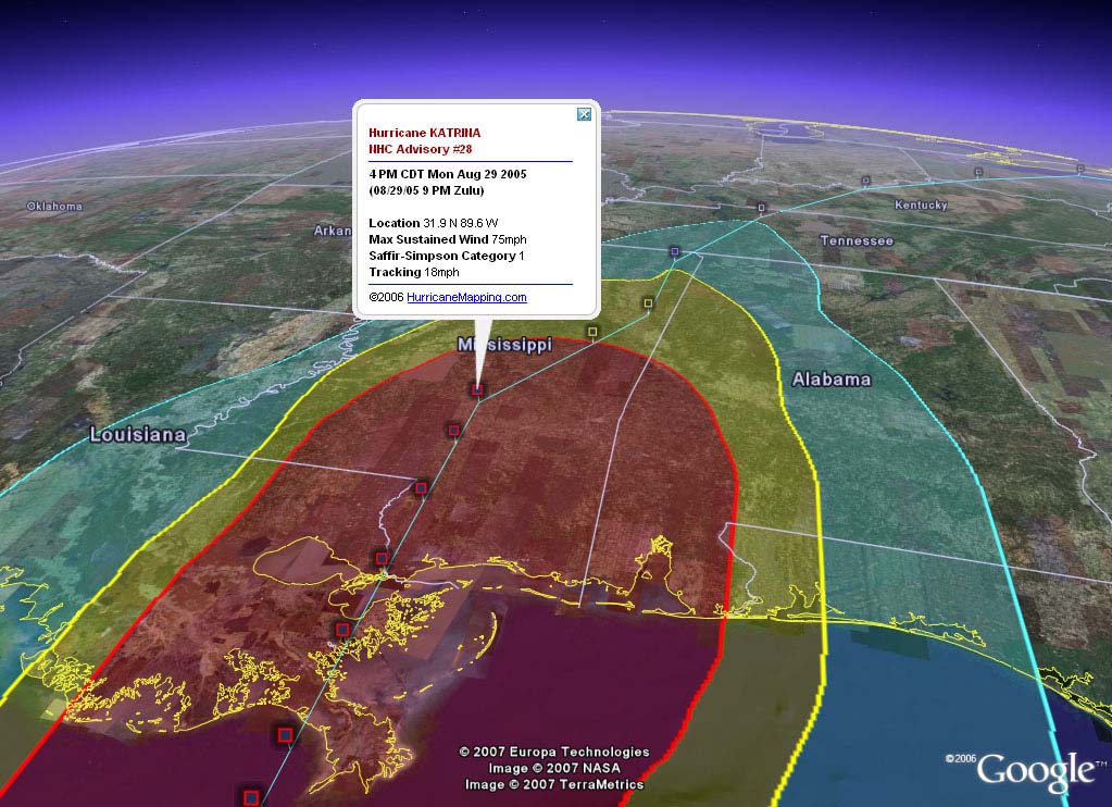
A Google Earth example:
Hurricane Katrina's wide path of destruction is illustrated here in HurricaneMapping's past wind swath. Combine this storm track data with simulated flights down to the ground to view Google Earth's high resolution imagery of damaged areas--an easy and effective presentation!
See a full-size version of this screenshot
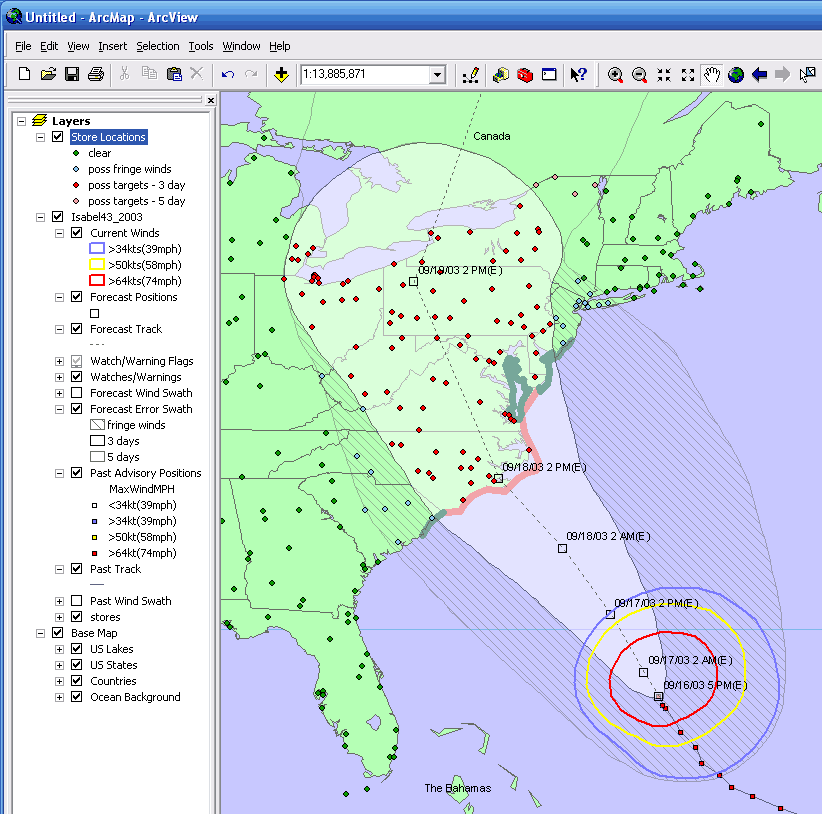
An ArcGIS example:
With Hurricane Isabel 48 hours from landfall, which of your store locations would be within her potential path? A quick spatial join of your facilities data with HurricaneMapping's forecast error swath for the latest advisory will give you the answer you need.
See a full-size version of this screenshot
Share your work...
Let us know how you're using HurricaneMapping data. Please send us your stories, screenshots, datasets, and more. We'd like to share your ideas with other subscribers and look for ways that we can continue to improve our datasets. Thanks!