
Support
Shapefile Manager Software
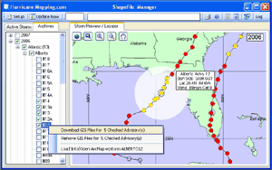
Subscribers to HurricaneMapping's Shapefile datafeed are advised to install Shapefile Manager. This FREE lightweight desktop utility will assist you in monitoring live storm activity and managing downloads of shapefile advisory packages.
 Installation instructions are
provided via e-mail when
you first suscribe.
Installation instructions are
provided via e-mail when
you first suscribe.
Documentation:
Download Shapefile Manager software (registered users)
Version History:
Version 1.0.11 - February 12, 2014
Fixes a problem with login after initial failed attempt.
Version 1.0.10 - September 9, 2009
Corrects errors that mention 'demo' mode whenever the program is unable to connect to the website to download files.
Version 1.0.7 - August 7, 2008
Added support for 64-bit Windows machines.
Version 1.0.6 - May 9, 2008
A minor change to alert subscribers that datasets from historic storms may be requested by e-mail if they are not already available in the HurricaneMapping.com archives. Previously, the alert had stated that these historic datasets would be made available after the 2007 beta season.
Version 1.0.5 - November 26, 2007
Shapefile Manager now loads a set of Tropical Cyclone Wind Probability layers for storms in the Atlantic, East, Central and NorthWest Pacific. These official NWS Tropical Cyclone Wind Probabilties are available in 6 hour increments out to 120 hours and for 34 knot, 50 knot and 64 knot wind categories. The probability products take into account the track, intensity and wind structure uncertainties from the operational forecast centers, based on their performance from the last several years.
Version 1.0.4 - July 26, 2007
Program now displays connection errors on timeout controlled panel so system continues to try for connection rather than waiting for manual ok. Rain and flood layers have been added to the ArcMap display package in NHC area of responsibility (Atlantic and EPac).
Version 1.0.3 - July 2, 2007
Adds capability to view Indian Ocean cyclones on the map. North Indian Ocean storms are in West Pac & IO bin, and South Indian Ocean storms are in South Pac & IO bin.
Version 1.0.2 - June 8, 2007
This version adds instant message capabilities for new storm advisory alerts. Also improves performance of the program in a number of areas.
Version 1.0.1 - March 10, 2007
This version corrects a bug that causes Advisory Highlighting in Archives to repeat rather than automatically erasing upon subsequent selection of an advisory for another storm. This resulted in a lingering highlight (white circle) when transferring to other screens or to the Actives tab.
Version 1.0.0 - March 5, 2007
First version introduced with startup of HurricaneMapping.com.
Did you know?
If you're away from your desktop computer where Shapefile Manager is installed, you can still retrieve advisory packages anytime and anywhere using a web browser.
Enter your subscriber login information above and select the DATA ACCESS page.