
2008 Tropical Weather Review
Below is a short summary of the season worldwide with select HurricaneMapping datasets from a few of the most notable storms of the year to download for use in Google Earth and ESRI's ArcGIS. These HurricaneMapping datasets are free for non-commercial use. If you have a commercial use, please contact us.
Links to all available year summaries: 2010 | 2009 | 2008 | 2007
 Atlantic Basin

Atlantic Basin saw a total of 16 named storms and 8 hurricanes in 2008. Tropical Storm Fay, Hurricane Gustav, Hurricane Hanna, and Hurricane Ike were particularly significant in their rapid succession and impact on Carribbean islands and Gulf Coast states.
For a complete picture of the 2008 season, read the National Hurricane Center's Tropical Weather Summary.
Tropical Storm Fay Advisory #20 (Wednesday, 8/20/08 at 11AM Eastern) nearing it's second of landfall in Northern Florida showing heavy rainfall predicted:
(HurricaneMapping files for this advisory in KML format | Shapefile format)
 Hurricane Gustav Advisory #24 (Saturday, 8/30/08 at 1PM Central) crossing Western Cuba as a strong Category 4 and forecasted to reach Louisiana in 4 days:
(HurricaneMapping files for this advisory in KML format | Shapefile format)
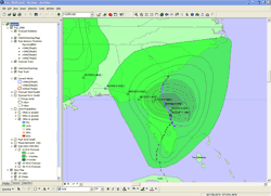
Hurricane Hanna Advisory #31 (Thursday, 9/4/08 at 11AM Eastern) as a strong tropical storm forcast to reach the Carolinas in 3-4 days:
(HurricaneMapping files for this advisory in KML format | Shapefile format)
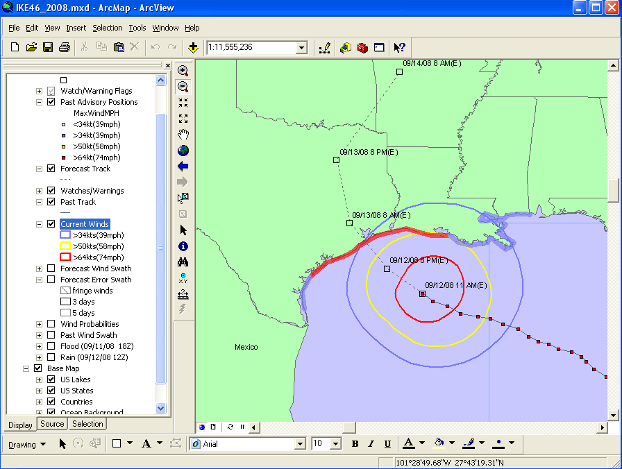
Hurricane Ike Advisory #46 (Friday, 9/12/08 at 10AM Central) as tropical storm-force winds reach Galveston, TX:
(HurricaneMapping files for this advisory in KML format | Shapefile format)
East and Central Pacific Basins
These basins were relatively quiet in 2008. None of the 7 East Pacific hurricanes reached the Central Pacific and Hurricane Kika was the only storm to form in the Central Pacific and it remained far south of Hawaii.
Hurricane Kika Advisory #22(Friday, 8/12/08 at 9AM Zulu) in final stage:
(HurricaneMapping files for this advisory in KML format | Shapefile format)
 West Pacific, South Pacific, and Indian Ocean Basins
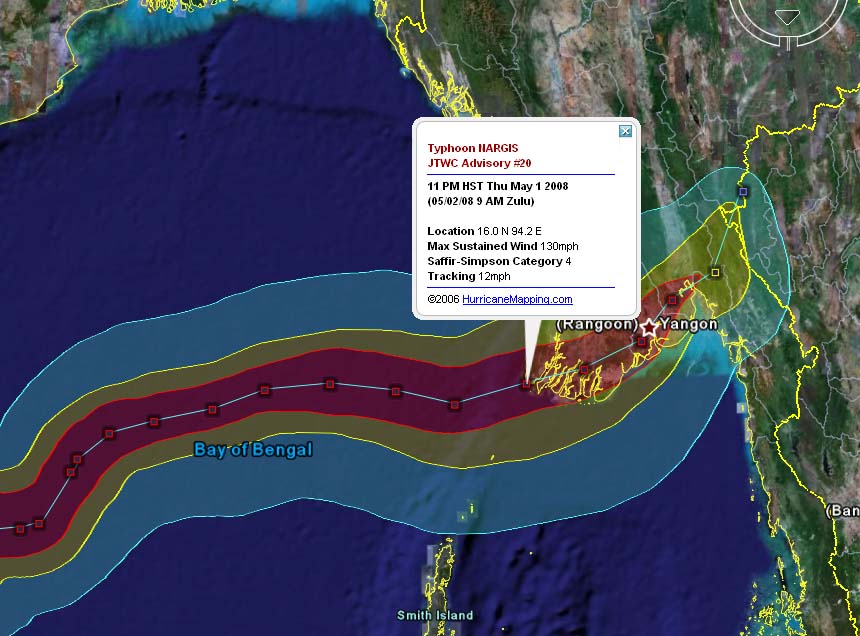
A total of 24 named storms appeared in the West Pacific and North Indian Ocean basins in 2008. Most notable was powerful Tropical Cyclone Nargis which caused major devastation in Myanmar. A total of 21 named storms appeared in the southern hemisphere in 2008
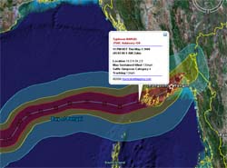
Severe Tropical Cyclone Nargis Advisory #25 (Saturday, 5/3/08 at 3PM Zulu) is the final Joint Typhoon Warning Center advisory:
(HurricaneMapping files for this advisory in KML format | Shapefile format)
_______________________________________________________________
Want more data from HurricaneMapping? Sea Island Software offers affordable subscriptions to KML and Shapefile datafeeds for live storm tracking and access to historic storm advisory datasets. Subscription Plans >>>
Need more information about HurricaneMapping's KML and Shapefile dataset specifications? Refer to the KML Dataset Description and Shapefile Dataset Description pages for details.